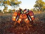
After filling all our panniers to the brim, we had 4 more panniers worth of things left over. For some reason I had decided 8 was the minimum number of pairs of socks to take, plus lots of extra clothes we didn't really need. Linda tactfully suggested if I wash all the clothes, and they'd fit in for sure, just like I managed to do with her favourite jumper the day before. A quick trip to the laundromat, post office to mail "home" the excess items, and (most importantly) the self-storage units resulted in all our remaining gear inside our modest carrying capacity. Tragically there was no room left for any food.
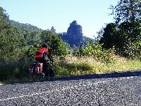
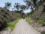
 We enjoyed nice cycling and nice winter weather up the NSW coast. And if the scenery wasn’t enough, we had fun re-naming the roadside properties from "Idle Acres" to "Muscle Acres", "Back Acres" or "Head Acres" etc.
After a cool morning we cycled over Noughton's Gap between Casino and Lismore. Halfway down the hill we found an injured wallaby (broken leg). After much effort with varying degrees of success (including a failed attempts to get help at a nearby farmhouse), we ended up cycling back to the top of the hill (to get mobile phone signal) and contacted WIRES (WIldlife Rescue Service). Help was promised, but in the end the Police were sent to euthanase the poor bugger.
 Nimbin is a strange little town. For those who don't know it's the dope-smoking hippy dropout centre of Australia, where commune living is the go. Linda was nervous about the place, probably as a result of the series of high-speed police responses as we approached town. I think Nimbin's rainbow painted building's decorated with leftist graffiti don't describe the town as well as the appearance of it's occupants. There were people walking, sitting, and generally just hanging around every inch of public space in town. There may not have been a formal town dress code but everyone was in uniform. I guarantee that whatever you are wearing now, worn into Nimbin would make you feel more over-dressed than a garbo collecting the rubbish in Tux. And as for the all the nicotine free smoking, lets just say that fresh air in Nimbin is at a premium. The designer European imported vehicle of choice that really shows you've arrived is he VW Kombi van. You can also be certain no-one will ever become wealthy in Nimbin by cutting people's hair.
 The complete lack of any planning controls along the Gold Coast holiday strip has resulted in some rather innovative architecture. There is no one style to speak of. Tuscan villas sit next to Spanish gabled mansions, next to 30 story holiday apartment skyscrapers, next to weatherboard beach shacks. Architectural principles of seamlessly blending buildings into their surroundings have been thrown out the window, with every property trying to out contrast it's neighbour with distinctiveness. The clash of colours and styles is enough to give anyone a headache, or a laugh when you realise how much someone's multi-million dollar dream home looks like the space craft "Red Dwarf". Mercifully, the half-life of buildings here is less than twenty years, so if you don't like it now (and who does?), just wait a few years and it'll be completely different.
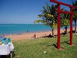
 The beach at Alexandria Bay near Noosa Heads is a designated nudist beach. It is not signposted as such, in fact it the signs ask everyone to report "suspicious or indecent activity to the local police ASAP". The local council has also proposed an exciting new initiative for nude beaches: surveillance cameras. Purely for the bather's protection of course, presumably by keeping potential pervs away from the beach by allowing them to watch from home on the net.
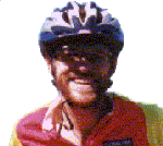
At this early point in the ride I’m still whiter than a Norwegian virgin, having seen no sun at all under my leg warmers. At the end of a day's cycling the removal of my helmet reveals I am probably not completely human. I have three brown stripes running down my (increasing) forehead where the sun shines through the ventilation slits of my visor, and a decent does of helmet hair makes me look like a Star Trek character.
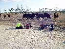 Bits of the far northern Bruce Highway are quite narrow. At one point we got run off the road by a series of trucks passing each way. We ducked off the road and straight into a patch of thorns. I spent the next hour plucking about 50 odd thorns out of our tyres. In front of some very bemused cows.
 From Townsville we caught the ferry to Magnetic Island and walked out to "West Point" along what our map marked as a walking track. Magnetic Island is a large granite outcrop and has some very pretty beaches. After two hours of hiking we reached the beach and were greeted by an unusual warning sign. In addition to the usual dangers of Marine Stingers, Sharks, Crocodiles, Stone Fish, Cone Shells, Snakes yada yada yada, beach goers were also warned to beware of air to surface missiles. The waters just north of this spot are used by the military for testing these high tech weapons. As if the warning wasn't enough, the sign went on to threaten beach users interfering with air to surface missiles might attract a $500 fine.
 After some unplanned dirt road riding around Innisfail, Australia’s wettest town I found a 3cm slit in my front tyre. As one might expect it was just as I finished playing with the tyres that the rain stopped. 4km later I noticed a suspect noise from my front wheel and a sudden loss of steering. In less than the time it takes to scream a panicked "f$#@ me" a huge bang and clunk as what was left of my front wheel it the bitumen as I swerved all over the wrong side of the road to an uncontrolled stop. This wheel has the only non-standard rim, and had always been loose fitting. Too loose for the folding tyre, and it just rolled off mid flight. And yes, it started raining again.
 In the Atherton tablelands high above tropical Cairns we stopped at the lovely Lake Echam, and strolled by the translucent waters to the turtle viewing pontoon. The saw-shelled turtles in this lake do have a saw shaped shell, but are interesting for another reason. Unlike common Australian freshwater turtles, these ones have the peculiar ability to breath through their bottoms. If only we could all be so fortunate.
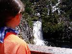
 Went in to Mt Hypipamee to view the Dinner Falls on the upper Barron River, and "The Crater". "The Crater" is a deep hole in the ground formed as a steam vent from a massive volcanic eruption that happened not too long ago (geologically speaking). It was formed in seconds as water that had seeped through porous fractured granite to the magma of the erupting volcano, resulting in one helova bang.
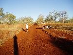
 From Mt Garnet the undulations common to the Atherton tablelands continued, but the road reduced to just one lane wide. As we past the "road narrows" sign, another sign warned us that this road also allows 3 trailer road trains. 300m after passing this sign we had to hit the dirt to make way for one of these monsters. Getting off the road for a road train is not normally an issue for us, but it's a real bummer when you end up in a patch of thorns.
Lava tubes are cylindrical holes in the ground formed by fast moving lava. They are common in this region, produced by an eruption of the Undara shield volcano about 190 thousand years ago, which is the blink of an eye in geological terms. The whole area west of the ranges here is a one massive lava field. Undara set all kinds of volcanic records, and the tubes are also the longest, biggest, most colourful etc, lava tubes in the world. But perhaps the most amazing thing about them is they weren't really discovered until the 1970s. The incredible network of lava tubes that runs for hundreds of kilometres only cam to light as a result of military areal surveys.
 Cycling across the "Little River" bridge I was admiring the water lilies and wondering what else might live in the waterhole under the bridge. This thought prompted the log sunning itself on an island in the stream to open its' jaw and paddle off into the water. I think it was a freshwater crocodile, but it could have been a small salty.
 The road runs next to the rail line for the "Gulflander", a rather eclectic train system that still connects two of the smallest towns in the world for no particular reason. It's now a tourist attraction, the sort that says "come and look how backward we are up here"! Anyway, this railroad pioneered lots of technologies that allowed it to be constructed and maintained relatively cheaply. With curiously shaped iron sleepers, the line is designed to work underwater, so no need for any of those expensive bridges or earthworks. This is just as well, as the route covers lots of low flat country that during the wet season half sits under six inches of water.
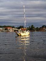
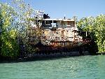 Karumba is a small town on the Gulf of Carpentaria. This is a refuelling and service centre for the Gulf of Carpentaria fishing fleet, and is the port for the Pasminco Century Zinc mining operation. Tourism is also a major industry, and the biggest attraction is not the azure waters (and they really are azure), but fishing for the Barramundi that live in them. My expertise in this field does not extend beyond "I'll have my barra grilled thanks". Just up the river is an old lugger that was beached in the last major cyclone in 1974. The local osprey family have been nesting atop the main mast ever since.
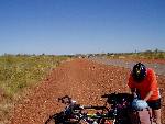
 The track down to Cloncurry is a 400km long formed dirt road that is two lanes wide with a single lane of bitumen paved down the centre. With light traffic, most vehicles spend most of the time on the bitumen. When two cars approach each other they each pull to the left, half on the dirt and half on the bitumen. Sensible drivers slow down a bit too, to minimise the impact of the scatter of stones from the half not on the bitumen (locals don't bother though). Road trains are a special case on single lane bitumen. Most drivers pull off and give the road train the entire bitumen lane every time. No-one tries another technique more than once!! A normal vehicle pass usually means each car uses 1/3 of the available bitumen with 1/3 left as a safety buffer. But when passing a cyclist, it's Raffey's rules! Some drivers pass us like they are passing another car, allowing us to do the same, riding safely on the far left of the bitumen. Nice drivers even slow down so we don't get showered with spitting rocks. However, others pull their cars just a fraction off the centre off the road, leaving us just the bitumen they don't "need" (rather than the 1/2 we are legally entitled too). Depending on the width of the road, the width of the car coming towards us, with width of its caravan, and whether the driver remembers he has extra wide mirrors or not, we get between 1m and 0m of the 3m of available bitumen. And getting out of the way is no easy matter either. 1m is manageable (but hardly safe), and 0m is obviously impossible. Others drivers just grit their teeth and driven straight at us, asserting their right of might. There is a serious lip bounding the bitumen from the dirt (dangerous and difficult to do), and the dirt verge we are often expect to use is usually rocky and sandy, which means hitting it at speed means you can't steer, and will probably crash. That's OK because often we need to spend half an hour plucking the thorns out of our tires as a result of such an expedition anyway. So we get off the bitumen rather reluctantly. It's like playing a game of chicken every 15 minutes. One guy had offered us a paltry 15cm of road (taking his four wheel drive off the bitumen was obviously not an option), and I was waving madly at him to pull over. He just waived a friendly cheero back as I crashed off the road. I found the best method of turning a dangerous to safe pass was an "acted wobble", where I steer right, but lean left. The result is the bike wobbles way into the path of the oncoming car, but quickly lurches back onto a safe course. It makes me look rather less competent than I am (not easy!) and we’re given more room as a result, sometimes. In fairness, much of the safety problems stem from most of the tourists being, shall we say, very life experienced. Having lived a very long time most of these people think they know everything there is to know about driving on outback roads they've never seen before. It makes them very unpredictable, and our regular games of chicken very interesting.
The people who attend the Mt Isa Rodeo really love animal shit. They chose jobs that allow them to be close to it. They wear it on their clothes. They wear stupid looking broad brimmed hats to keep the shit on their clothes fresh for as long as possible. They don't use tents, they use swags so they can sleep with animal shit and have wet dreams about it. They even hold tournaments to see who can roll around in animal shit the best, and they *really * get off on watching other people rolling around in animal shit. They are quite literally complete shit-heads, and they obviously think other people without the same interest in shit are a waste of space. There is some suggestion this event is just an excuse for a piss-up and the odd harmless orgy, but that's just the socially acceptable cover for their real sordid activity.
 So why the attitude? Well one of those shit-heads decided that issuing me the bird wasn't enough, and threw full chutney jar at me as they drove past. The best thing I can say about this shit is he must be a great shot. I didn't see it coming (which is probably just as well) but the jar travelling at a relative speed of 140km/h hit me flush in the back of the head. Linda didn't see it coming either, but she saw it bounce high of my wooden noggin. Shit it hurt. I thought I'd been hit by a passing car, until I realised I was still on the bike and my lungs weren't punctured. The smell of the goop now running through my hair told me the payload of the missile, and the damage done to my bike helmet demonstrated the force of the impact. If it had hit an unhelmeted part of my head (and I ducked just before impact to shield my face from the wind of the passing traffic) I'd probably be dead. If not from the blow but from being knocked unconscious and thus steering my bike into the oncoming traffic or off the cliff next to the road. In any case I must have suffered some sort of brain damage because I can now see all these irritating misplaced apostrophes in my earlier journals.
So, maybe it's unfair to target everyone with the same brush, but as far as I'm concerned these bumkins deserve all the respect their stupid appearance, accents and revolting smell engenders. As highlights of the Mt Isa RODEO (Rolling On Defecation Excrement Overtly) were shown over dinner I was audibly cheering the bull, urging him gouge the guts out of the clown in the silly hat, and pumped my fist at every injury inflicted. And, you can rest assured the Bike Odyssey corporate empire will never *ever* sponsor the Mt Isa Rodeo.
 We pulled off the Barkley Highway to allow the roadtrain we could hear coming up behind us on a blind corner to pass. We waited a minute as we thought we could hear another coming up behind us. Instead as small aeroplane flying less than 15m above the deck and tracking a course directly over the road buzzed past.
 Along the Barkley Highway there occasional windmills that were originally placed to provide water to passing travellers. It’s been a long time since there were serviced or provide water for humans, but they do provide a gathering point huge flocks of galahs and finches.
 On the Victorian Highway out of Katherine we met Neil, an English cyclist with 65kg of gear in his full set of panniers *and* a fully loaded trailer. Neil was having a hard time with the trip and the wind, all his luggage, his very un-aerodynamic bike and the chest cold he'd picked up.
 The rest area at 100km from Katherine was small, dusty, fly blown and every potential camp site had been used several times as a toilet. I don't know if I was happier discovering this after eating lunch or not. By the time Neil lumbered in (an hour after us) he was cursing Australia and everything that lives here. Neil was not enjoying his trip! We sat and recovered for a while, and eventually convinced Neil to ride with us a few more Ks to find a better camp site. 2kms turned into 10kms (sorry Neil!), and we eventually camped up a station track with a wire gate that took three intelligent adults only 20 minutes to work out how to open and close again.
 The road plunges into the Victoria River valley, and the scenery is sensational for the next 100kms or so. Red hills, cliffs with palm trees fringing their base, pandanus, the first boab trees and the usual array of Australian eucalypts. And, it is rolling downhill to boot!! This makes fantastic cycling, and even poor old Neil conceded that this was a bit more like what he was expecting, in between complaints about the up rolls and odd gusts of cross wind - whingeing poms!.
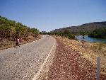
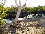
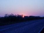
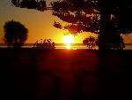
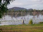 We woke early to see the magnificent sunrise over the lake at Kununurra with the jacana birds walking on the lilies and the sun illuminating the surrounding cliffs, then we went back to bed. Or maybe I just dreamed the whole thing. By the time I awoke for real there were powerboats out there.
 After a long day of climbing through the mountains of the Kimberly we sat exhausted by the side of the road. A mine ute turned around and pulled up next to us, suggesting there was a great water hole "just up 2kms up the road!". With a spring in our pedals we charged off. 15km later we found their lovely water hole. Thanks guys, that tip was *really* appreciated!
 Amazingly foggy morning. Condensation everywhere after a few ks of riding. On my bike, glasses, arms, legs and beard. We are 200km from the ocean! A kangaroo darted across the road, but we hardly saw him.
We cycled right up to Broome’s town beach, where the swimming is excellent if the tide is high enough. We started walking out to the water's edge, and quickened our pace when we realised the water was receding faster than we were approaching it. About 17km from shore we dived into the 9cm deep (at the crest of the waves) water for a refreshing swim in the Indian Ocean. Slipping into the azure waters is almost as effortless (if that's the right word to describe our method of getting here) as slipping into the laid back life style the locals call Broome time.
 We planned to see the "good light in Broom" at the "staircase to the moon", where the full moon rises over the low tide mud flats creating a stunning visual effect. Actually it’s a great excuse for everyone in Broome to head to the pub (apparently the best vantage point for viewing this natural wonder) on a week night. You know how the full moon often looks huge on the horizon as it rises? Well, here it doesn’t. In fact from four deep in the crowd along the Roebuck Bay breakwater it looked pretty tiny, and not even all that bright. That didn't stop thousands of photographers (myself included) attempting to visually document this thrice a month event, with most of the cameras attempting to make the moon just that touch brighter by letting of their flash. Don't get me wrong, it was worth the effort to go an see (as in the effort to hop on the bus to the town beach, not the cycling 7500km), but I guess my expectations were rather astronomical. However the food was excellent and the company even better.
The Great Sandy Desert is 650km of flat, featureless cycling through one of Australia’s great wilderness areas. It boasts the longest stretch of highway 1 without a permanent water source (270km), some of the country’s least inspiring scenery and a well earned reputation of horrible headwinds. Fortunately we’d avoided the cyclone season. To give you some idea of what constant headwinds and dull scenery can do to a cyclist’s brain, here is my log from day 3 of our crossing:
 Central Port Hedland isn't much of a town to look at. The town is located on a sand spit on the coast, which is very scenic, and if it weren't for the crocodiles, marine stingers and super ore ships would make a nice spot to swim. The spit is wedged between the ocean and salt flats and is just a touch too small to hold enough residential buildings (as well as being hopelessly cyclone prone) so South Hedlead is taking over as the residential and retail centre for this community. The only reason I can see the old centre of Port Hedland survives as a commercial precinct is some idiot in Melbourne decided to close the bank branches in South Hedland. This is of no small annoyance to the locals as this is where most people (and businesses for that matter) reside, and now need to do a 30km round trip to the least accessible part of town to do their banking.
 After the dullness of the Great Sandy Desert, the ride inland to Newman through the Hamersley Ranges was amaisingly beautiful.
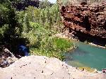 Karajini National Park has just 10kms of awful gravel road to seal before we can reasonably cycle to the best bits. Maybe next time. Instead of cycling we took a commercial tour that covered the major gorges. Karajini's gorges are absolutely gorgeous! Red ferric cliffs surround crystal clear (almost) permanent water that seeps out of the walls and into the most perfect swimming holes imaginable.
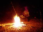
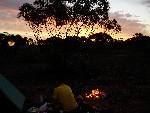
 There were lots and lots of bush camping opportunities cycling from Newman to Meekathara. We had a huge choice of bush track, and we set up camp well out of sight of the road. During our water bottle shower I asked Linda "is that voices I can hear?". I've never seen anyone put on a shirt so fast! Out in the middle of nowhere, with thousands of places to camp we'd picked a spot less than a hundred metres from someone else (who we never saw - just heard coughing occasionally).
 After a long 200km ride into Mt Magnet, the weather was starting to look a bit threaterning. There were these big dark things in sky we’d last seen in the movie "Independence Day". Rain clouds and cool (less than 25C) weather were something of a novelty. However, we were greeted at the caravan park by people escaping a Perth winter (which we "thought" was something of an oxymoron) asking us "how are handling this heat?"
As we got closer to Perth the trees got a touch taller, there are wildflowers by the roads and it became harder to extract a wave from the passing motorists. I guess waving at each other is a strange thing for people to do just because they are no longer in the city, but remote Australia is so thinly populated that there is some comfort in recognising and acknowledging a fellow human being. The types of wave we have received (in increasing order of friendliness) include:
- The Bottle thrown at the head (obviously the worst)
- The Bird (same offenders as above)
- The shake of the head
- The stare straight through as if you aren't there.
- The jaw drop
- The lifting of one finger (NB: It can't be said an Aussie wouldn't lift a finger to help someone in trouble in the outback. They may well drive straight past a stricken traveller, but they will at very least lift just one finger to say hi.)
- The lifting of two fingers.
- The lifting of four fingers.
- The point and shoot: point index & ring fingers at target then raise the thumb.
- The V for Victory (I think).
- The standard one hander.
- The thumbs up.
- The double thumbs up.
- The Salute.
- The Narly Dude: raising only thumb and pinkis. (NB: Try making "narly dude" sound reasonable with an Aussie accent).
- The Look Ma, No Hands! : wave with both hands at the same time).
- The Gimme Five: arm stretched straight out the window.
- And my favourite:
- The "HOWZAT!!": Reach for the sky with all finger's fully extended. The best example had multiple arms coming out all windows at the same time.
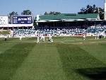 We stayed for a couple of weeks in Perth relaxing at Linda’s sister’s place. One day we caught the ferry across to Perth City and watched Australia take on the might of Zimbabawe in official test cricket. Mathew Haden batted like an old fart, edging and snicking his way to a hundred. He brought up his century with a sweep shot, the twenty first he'd attempted, and the fourth where he'd managed to hit the ball. I'm obviously a good judge of the game. He went on to post the world record highest score!
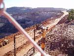 After a straightforward weeks cycling (at least it would have been if we hadn’t put on so much weight lazing about in Perth) we reached the goldmining centre of Kalgoorlie. Here we met up with Linda’s parents, on a driving holiday to Perth. Kalgoorlie is dominated by the following industries: Gold Mining, Stock Broking and prostitution. In fact Kalgoorlie's Hay St is famous for it's walk up brothels. I really wanted to have a gawk, but it was always going to be a tricky proposition with my wife in tow - let alone my mother in law !!!
Two days into the Nullarbor crossing we reached the Balladonia Roadhouse which sold us bread, but refused to give us water. Asking why not brought a tirade of all the problems they have getting water trucked from Norseman etc etc. They can spare enough precious water to fill their swimming pool, but don't have enough for pedal cyclists. In response to my incredulous look, it was added that no Nullarbor roadhouse would give us water, that no cyclists had ever been given water at that roadhouse (with the anomalous exception of ourselves four years earlier). So we might just as well turn back now. Charming.
 We sped past the emergency phone at 14kph. Last time it was 40! I can now say from experience that the 90 mile straight is a great place for a tailwind, but a terrible spot for a headwind. What took just less than 4 hours last time took 24 hours this time. The country continued to open up to grassy plains with scattered trees. And *lots* of wind. We saw some wedgetail eagles in a tree. Apparently these used to be really common along here, but since the Calisi virus removed most of the rabbits they are now rather rare.
A car was towed into the Caiguna roadhouse. We got to chat to the owners a bit later. It turns out they were dudded by their roadside assistance organisation. Caiguna is just too far away to get help, so they were on their own. This is the real Nullarbor!
 The day to Eucla was something of a dream. In fact it started with me dreaming I was reporting for the ABC program "foreign correspondent", sharing a chai and chatting away to my interviewee, a certain Mr O BinLarden. We actually managed to find a single point of coming ground. Something about an appropriate treatment for wayward caravan drivers. After three days of soul sapping headwinds, we had the wind at our backs and a spring in our pedals. The Roe Plains are very flat, and very exposed with only occasional patches of trees. So here, the tailwind was heaven sent! It was magicly easy riding, except for the last 1km, which is steeply uphill. The 237th K (a new Personal Best) was the hardest of all!.
 Across the western agricultural belt of South Australia (does that make sense?) we have passed through some really nice little towns. Streaky Bay, Wudinna (as in "David,Wudinna put the garbage out?"), Kimba (named after a white lion) among others. Iron Knob (I don’t know who it’s named after) isn't one of them. It has the desolate look of a lot of remote Australian towns: red dust, no grass, dilapidated buildings and a vicious dog barking from every address for security. Everything loose needs to be tied/locked/chained down, even the water tank at the town Post Office cum Tourist Info. When the cleanest, most modern and by far the most impressive building in town is old roadhouse, you know the prospects aren't looking good!
 We cycled south along a think called "the Reisling Trail". It's a 26km bike path with a fine dirt surface. By fine I mean thinly ground. It follows the old railway formation so it made climbing out of the valley a fairly easy affair. It took a lot of the fun from descents though, and pretty well stuffed the daily average. We anticipated having to dodge a few semi-sozzeled two wheeled wine tasters on this path on a Sunday afternoon, but all we had to dodge were blue tongue lizards and millipedes.
 The traffic riding out of the Adelaide hills was unbelievably manic. This is the worst and most dangerous driving we've seen in pretty much all of Australia. The roads are narrow with little or no visibility, but the locals hoon fly around them like they driving slot cars. We had numerous near misses today. To give you some idea at one point a car overtook us just in front of two oncoming oversized dirt trucks. The guy behind naturally thought he could just follow the leader around. He cleared us easily, but was within 2m of being crunched by 50 tonne truck. The complete indifference these people have to their own, let alone our safety, which makes it easy to see why there are so many crosses and black poles marking all the fatalities.
 Kingston SE is in a beautiful spot next to the sparkling Southern Ocean. It's not often the Southern Ocean is described like that, but today the Southern Ocean was indeed calm, blue and sparkling. I think that's our queue for a swim and day off. This town is so nice it is the closest we've come to finding the fictional Sea Change town Pearl Bay. The jetty even has Diver Dan's boat shed.
 We gave up out cycling shoes for hiking boots in the Grampians, at least metaphorically. In fact Linda retained her cycling shoes and I went for my cheap rubber sandals to walked up "The Pinnacle". We didn't have too much trouble climbing to the top, but after a splash of Victorian rain and our skate like footwear the descent was made very *very* cautiously!
 An old station wagon (The 1966 Holden Special - the model of car I understand I was conceived in) loaded with surf boards passed with a toot and a wave. 2ks down the road we passed through the microscopic town of Nirranda. No shops or houses, just a tennis court and church. On this Sunday morning quite a few parishioner's cars were waiting patiently for their owners to return from worship. To my surprise that including that surfboard laden shaggin wagon.
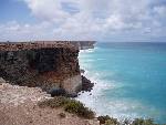
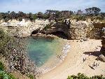
 This is variously the Limestone Coast, The Shipwreck Coast and the Surf Coast. It is indeed mostly limestone cliffs that are slowly dissolving into the southern ocean. It's occurring at an irregular rate with groups of islands that interface with the sea entirely with sheer cliffs. The bases of these are dissolving fastest with the help of the wave action from the huge surf bounding up from Antarctica. The result is a spectacular protrusion of tower like islands lining a very rugged coastline.
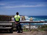
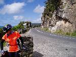 The Great Ocean road here is extraordinarily beautiful. It twists and winds around sheer cliffs just metres from the ocean. And it's not just a few Ks like this, it stretches for nearly 100km in this way along the coast here. When people aren't driving on the wrong side of the road straight at you, it's a lot of fun.
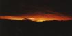
 A beautiful clear sunny summers morning in the Snowy Mountains greeted us. We wrapped ourselves up in all the warm cycling clothing we had, which isn't much. Five minutes later we were climbing the first hill of the day, and we were seriously sweating. By Mt Darragh we'd climbed from 700m to 950m, at least three times. From here the road plunges off the tablelands down into the Bega Valley. A 20km twisting descent, you little ripper! We could feel the air getting warmer as we got lower. And it was all through beautiful National Park and eucalypt state forests, with the cicadas ringing in our ears, punctuate only by the odd bird squawk. At the bottom the Pacific Ocean awaited us. That one last climb over Magic Mountain was one of the steepest of the trip to date, but took us to Linda’s parent’s place at the retirement centre that is now Tura Beach. This has to be one of the most beautiful parts of Australia, just watch out for duffers in hats.