Bike Odyssey
Alaska 2006
| Home FAQ Maps Photos Subscribe Links | |
 | |
| Trip Journals | |
|---|---|
| Europe 2007 Alaska 2006 Australia 2004 Europe America New Zealand Australia 2003 | New Zealand '02 | Sydney to Darwin '01 | |
| |
| Travelogues | |
| Europe 2006 Alaska 2006 Around Australia 2003 Sydney to Darwin 01 Around Australia 99 | Great North Walk 98 Snowy Mountains 97 Tasmania 96 | |
| |
| About Us | |
| David Linda Bike Odyssey E-Mail: djf01@bikeodyssey.com.au | |
| |
| Bike Odysseypty ltd | |
| BODY - The PHP Symbolic Debugger TimesheetMagic For a range of cost effective industry standard solutions contact the Systems division of Bike Odyssey Pty Ltd | |
| |
| Journal for 18-aug : Glenallen. |
|---|
|
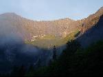
Nice fast riding to Lauterborg, for my last French bakery breakfast. Once over the border the veloroute signage improved markedly, which is just as well it was the only navigation tool I had here. Oh, and the sun came out (it disappeared the minute I entered France). Once through the maze of Worth the bike paths were a joy to ride. Reached a section closed, with a sign and a map of a 20km impossibly complicated detour. Ignored the detour and cycled over 3km on tricky loose gravel instead. Speyer has a magnificent transport museum, including a 747 stuffed and mounted, where visitors can walk out onto the wings. I tried to find if there was a campground in town, so I could stay the night and visit the museum. No joy. Got kicked off the veloroute again for more construction work just after Speyer and was forced to find my own way. This sort of navigation is proving extremely difficult for me. I have to find the centre of town (never obvious), find a local town map, find the roads I need on the map, then follow them. Invariably one of these steps goes wrong and I end up lost. I left Speyer at 1pm, and reached the centre of Ludwigshaffen at 4pm, even though it was less than 20km away. I got lost in Waldsee (3 takes at finding the right road out of town). I got very lost in Neuhofen (3km from Waldsee), and decided the short cut I was taking was taking way too long. So I hopped on the local bike path which the town map (took 30 min to find that) said lead back to the Rhein and the veloroute. The bitumen became pavers, which became gravel, which became narrow gravel, which became a dirt (ie mud) path. I turned around when it turned into a grass horse road. Finally made it to Ludwigshafen's outskirts. Ludwigshafen was terrible to navigate too. The bike route ran for about 10km on footpaths made of pavers, and any use of the road by me saw me loose the route. I lost the sun too (it always threatens to rain when I get lost), ensuring I occasionally misplaced north and south. Finally found the route to Worms. On the outskirts I stopped to check my maps and options. Whenever I stop on the veloroute people offer to help. I had already read the Worms campground was dilapidated and awful, but the locals thought it was so bad they would not tell me where it was. It was 60km to the next known campground, and I decided that even though it was now nearly 6pm, it was my best bet, *if* I didn't get lost again. I got lost on the way through Worms. (at what should have been the final turn I went left back into town instead of right onto the road out). So it had to be Worms and the terrible camp ground tonight. How do I find it? I trundled aimlessly around town looking for a "stadtplan" (town map) with no joy. Nothing at the train station (and no tourist info there either, just gangs of late teens and a lot of vandalism). There seemed to be some big festival on in the main part of town, with throngs of people and beer tents everywhere. Eventually I found a hotel with a concierge. Directions to hotels were the only half useful signs the town has. There I asked the price of a room (way too much) and directions to the campground. I was also given a tiny town map, which revealed the location of the tourist office. Tourist office had long since closed when I got there, but the map outside did reveal the location of the terrible camp ground: over the river. Cycled slowly over the pedestrian/bike way section of the old bridge (the new one isn't finished yet) and with some difficulty (route obstructed by bridgeworks) found the campground: surrounded by barbed wire with locked gates. I configured my cell phone for Germany (it worked !!) and called the number on the "Campground, Welcome!" sign. No answer. The last campground I stayed at had similar security measures, and there were a few caravans and people inside, so I hopped the fence to try and find someone to ask if I could camp. In the time it took to grab their alsations two big burly guys came charging at me, I think swearing at me. I said I didn't understand German so in perfect English he barked "climb back out of here or I'll call the police!" "Before or after you set the dogs on me?" I thought. They stopped whatever they were doing to make sure I left. They didn't even let me out, I had to climb back over the locked gate. So I'd been in the country less than 12 hours and already been threatened with arrest (which admittedly would have solved my accommodation problem). So I trundled back over the bridge and found the least expensive hotel I could (it was now nearly 8pm). Thousands of people milling about the streets, drinking at the beer tents, listening to the live music, watching the "fashion" shows (if just minimal underwear can be considered fashion) etc. It was a beautiful warm evening. So after washing myself for the first time in 3 days, I joined them for an hour or two, wandering the packed streets aimlessly looking at the various shops and a very cheap feed. Top of the list was a bratwurst sandwich, which I balked at (too much had already gone wrong today), and settled for a "donner" (a German/Turkish kebab). I bought something too: a camping directory :-). I've been carrying ADAC (German AAA/NRMA) maps, which mark the ADAC approved camp sites, of which Worms was one. So my first impressions of Germany are not all at positive. Woke at 5am, on road by 7. First 3km without rain, then rained non stop for 7 hrs. Covered 12ks before I saw a disturbing mile post sign: I'd done 4 miles :-(. Breakfast in abandoned rail tunnel. Long drag up Thompson Pass (825m) Not real steep, 6-7%, straight. Hitchhiker told me I was "real hard core" Stuffed at top (felt like spewing) but too cold and wet to rest. Put on vest for descent. Getting hypothermia when couldn’t pedal. Stopped at roadhouse at 97km, had burger and tried to dry out. Spent force the rest of the day, but massive tailwind (40kph, gusting to 70kph) kept me bustling along. No wildlife sightings, but warned of nearby black bear. Tried to cook tea at rest area, but too much wind. Dried out camping gear instead. Limped on past highway junction gas station to camp site. << Prev - Next >> |